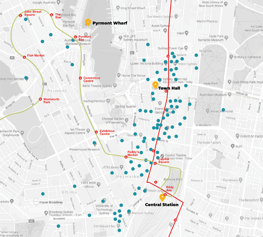
Making hay ahead of the coming sunshine, Sydney’s City Central Liquor Accord has launched an interactive map marking its member venues and their proximity to transport including the long-awaited light rail.
As the city anticipates the heralded relaxation of the trade-smothering ‘lockout laws’ and dragged-out construction of the light rail route, which has brought chaos to swathes of George Street and the southern CBD, the members of City Central Liquor Accord (CCLA) determined now was the time to push their locations and inherent proximity to transport hubs.
“After facing several years of challenges through the construction of the Light Rail project, we felt it important to provide a major promotional boost for our members with this initiative,” offers CCLA President Tim Dowman.
The Accord covers CBD licensed venues north as far as Market Street, west to the Fish Markets, east to Hyde Park, and south just past Central Station.
The interactive map shows the location of each, and presents contact details of a venue if selected.
“The idea is to promote our venues to people travelling on the light rail and other public transport links and show how easy it is to get into our part of the city to enjoy a great range of entertainment options.”
The CCLA has worked with developers Control Zone Online for the technical solution.
A major advertising and promotional campaign is planned for later in 2019 once the light rail actually opens.
The map is now available on the CCLA website HERE.